Would you love visiting a unique landscape with spectacular geological formations and home to the world’s oldest living culture? Visit Uluru-Kata Tjuta National Park in Australia’s incredible outback.
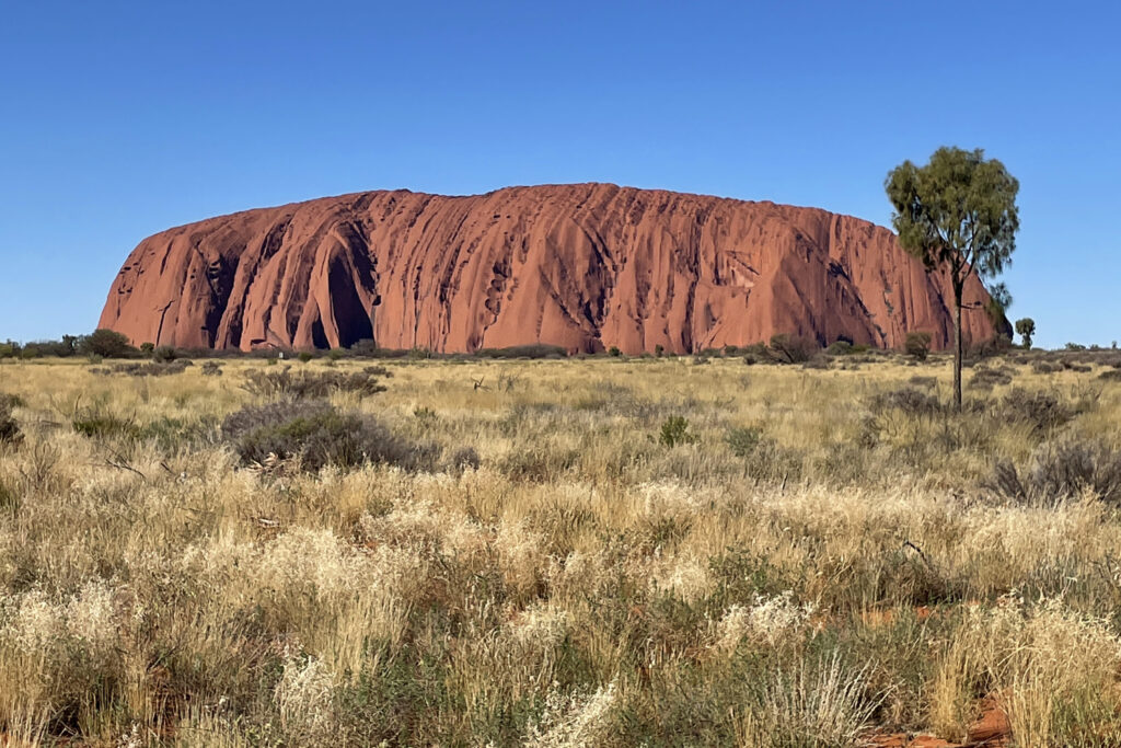
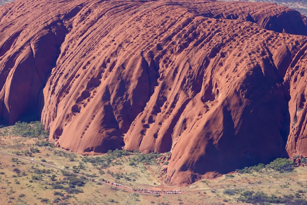
In the middle of Australia’s Red Centre there’s a spectacular rock formation rising out of a mostly flat plain. It was long known as Ayers Rock, but has reclaimed its original name — Uluru. We finally got to visit Uluru and it did not disappoint. It’s so huge it can be seen from miles away. It’s an iconic feature of Australia, and visitors come from all over the world to see it.
We love Australia. We’ve traveled here before, and we’re really happy to be back. We began in Darwin and looped through Litchfield and Kakadu National Parks. Then we boarded The Ghan train and traveled through the outback. During our stop in Alice Springs, we took a very exciting day trip to visit Uluru-Kata Tjuta National Park.
This article is about visiting Uluru. Here’s what’s covered:
- About Uluru-Kata Tjuta National Park
- What to do and see at Uluru
- Kuniya Walk to Mutitjulu Cave and Waterhole
- National Park Service information, maps and passes
- Getting to Uluru from Alice Springs and beyond
- Best time to go to Uluru
- Where to Eat
- Aboriginal ownership and co-management of Uluru-Kata Tjuta National Park

Visit Uluru-Kata Tjuta National Park
Uluru and Kata Tjuta are two of the world’s largest, most famous rock formations. Together, they form Uluru-Kata Tjuta National Park and are the heart of Australia’s Red Centre. Whether approaching from land or air, the two formations are striking because they are so large and stand so high on an otherwise mostly flat plain.
Uluru and Kata Tjuta are 50 km apart. Uluru is one giant rock; Kata Tjuta is a collection of huge rock domes. As large as these formations are, what you see is not all there is. It’s estimated that about two-thirds of these formations are underground. Both get their red color from oxidized iron in the stone.
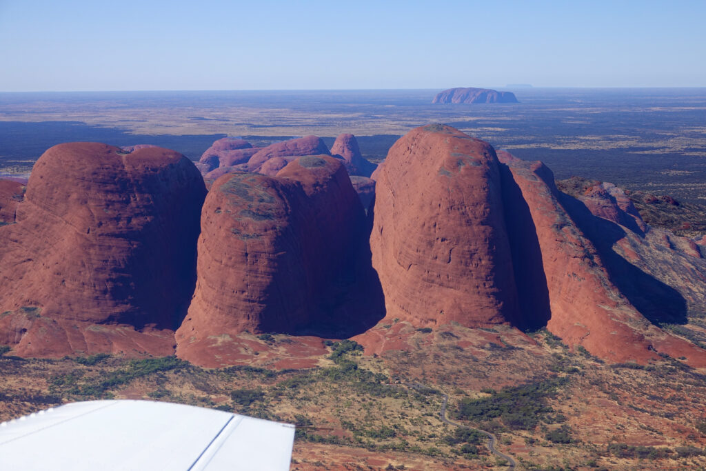

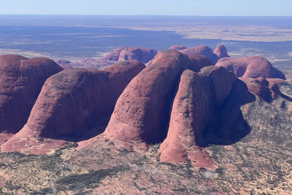
Kata Tjuta
Kata Tjuta (catta-jew-tah) means place of many heads because the formation is a collection of head-like domes. Kata Tjuda is also called the Olgas. The highest dome, Mt Olga, stands 550 m above the surrounding plain. (Source: NTAS brochure)
We flew around Kata Tjuda but did not visit it. According to the park’s visitor guide, the main sights are to take the Walpa Gorge walking track (2.6 km return) into the rock formation and to see the colors change during sunrise and sunset.

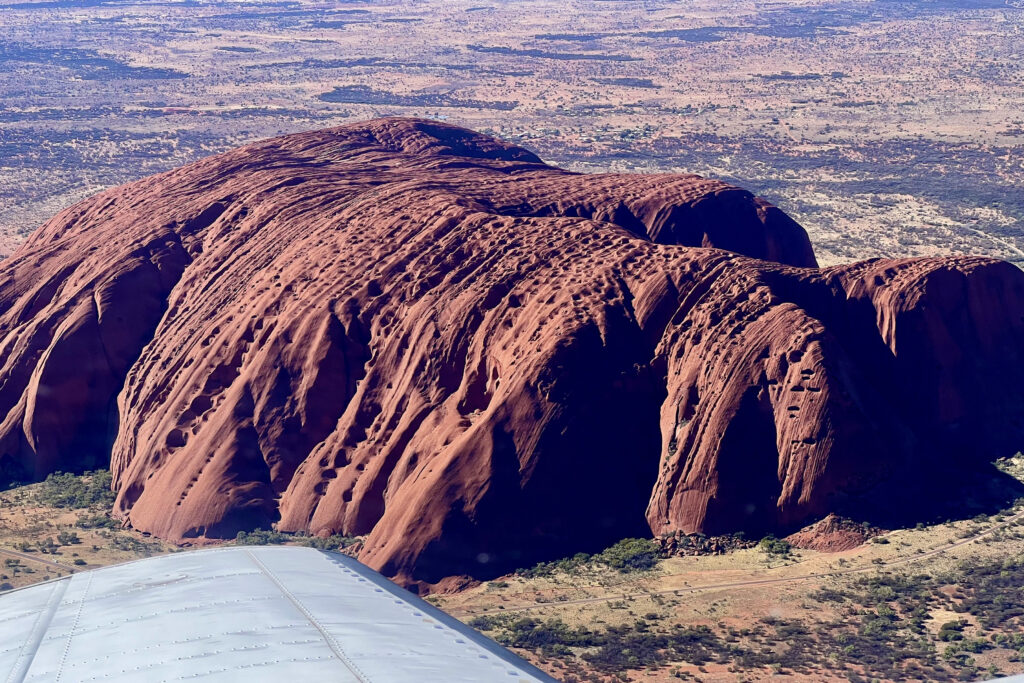
Uluru
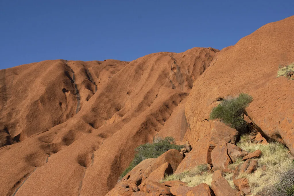
Uluru (ool-or-roo) means meeting place, and it’s been a sacred and sheltered gathering place for Aboriginal peoples for tens of thousands of years. It’s a single block of stone that is 10 km around the base and stands 348 meters above the surrounding area. It’s 600 million years old and formed at the bottom of an inland sea. (Source: NTAS brochure)
The area gets 200-250 mm of rain a year, and when it rains, water cascades down the pitted and terraced walls and into pools like Mutitjulu Waterhole at the base. It must be a spectacular sight.

What to See and Do in Uluru-Kata Tjuta National Park
Here are the top sights in Uluru-Kata Tjuta National Park. Since we flew from Alice Springs on a quick day trip, we only had time to take the Kuniya Walk and make a quick stop at the beginning of the Mala Walk. The rest of the items listed here are our wish list for a future trip:
- take the Kuniya Walk. See ancient Aboriginal rock art at Mutitjulu Cave and visit the Mutitjulu Waterhole (1 km return)
- take the Park Ranger led Mala Walk to Kantju Gorge (2 km return)
- walk all or part of the 10.6 km Uluru Base Walk (10.6 km return)
- visit the Uluru Cultural Center
- see Uluru at sunrise and/or sunset
- see the Milky Way on a clear starry night
- visit Kata-Tjuta and take the Walpa Gorge walking track (2.6 km return). Watch the sun rise or set on Kata-Tjuta
- if it rains during your visit, you could see waterfalls at Mutitjulu Waterhole and Kantju Gorge
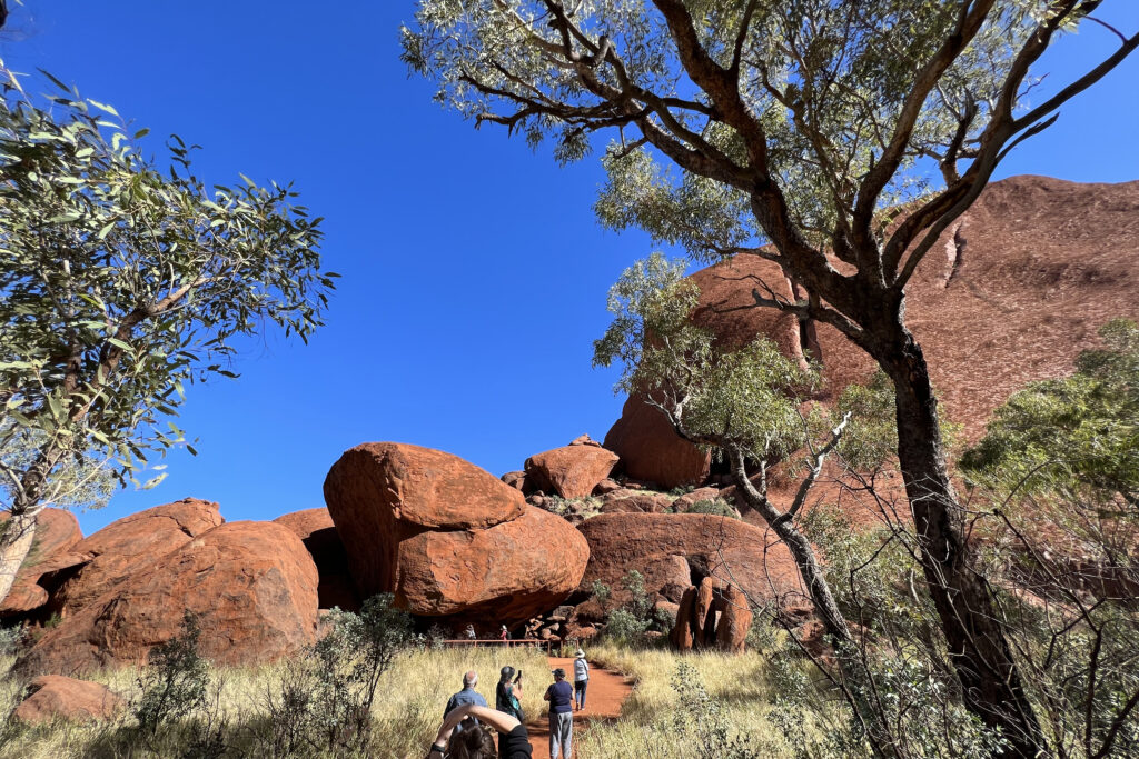
Kuniya Walk to Mutitjulu Cave and Waterhole
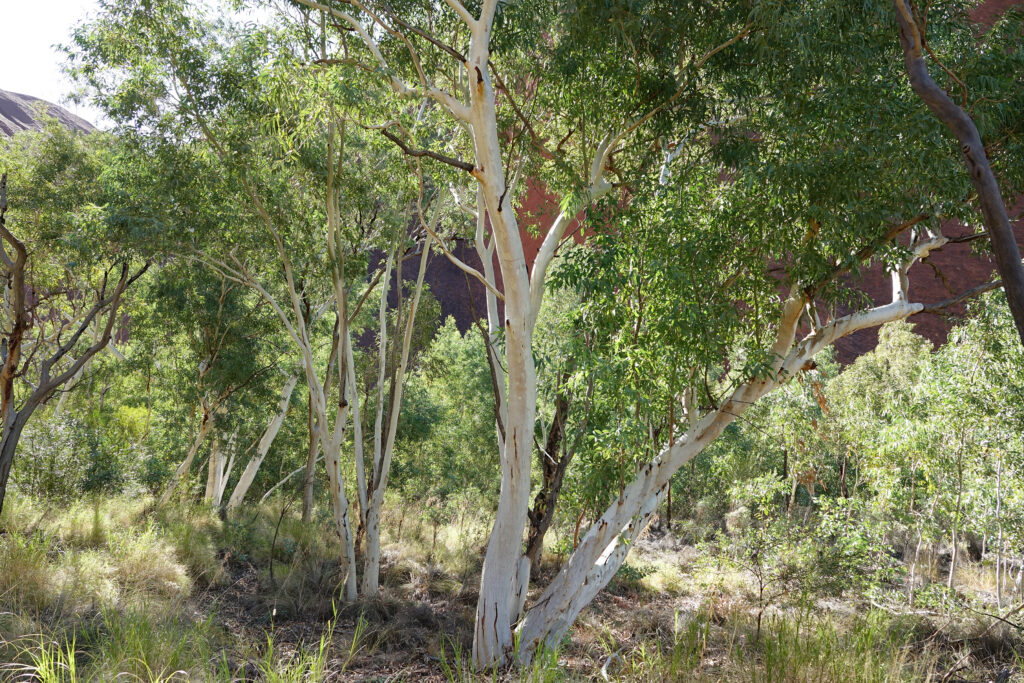
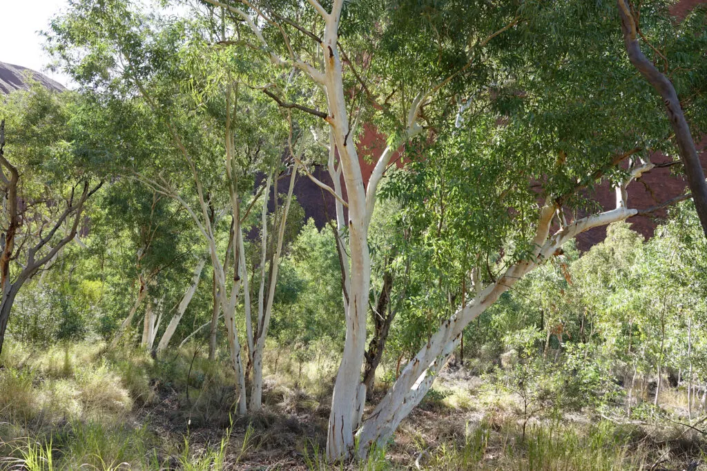
Our guide led us on the Kuniya Walk, which goes to both Mutitjulu Cave and Mutitjulu Waterhole. The 1 km return (round trip) walk begins at the Kuniya carpark. In between the cave and waterhole, the trail meanders through a peaceful wooded area with river red gum trees and tall grasses. We were told this is an area where you might see wallabies, but we didn’t.

Mutitjulu Cave and Rock Art
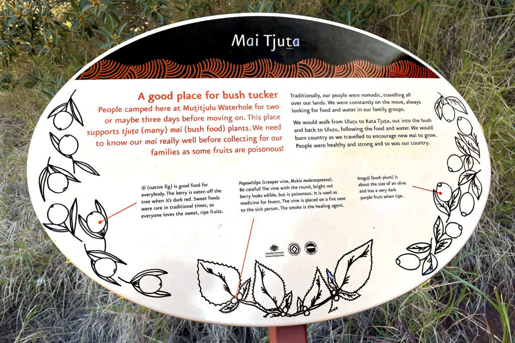
This is a family cave where generations of Anangu families camped. The men hunted and the women and children gathered bush tucker (bush food). They shared the food and the elders would tell stories as they sat around a campfire. (Source)
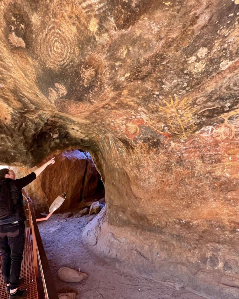

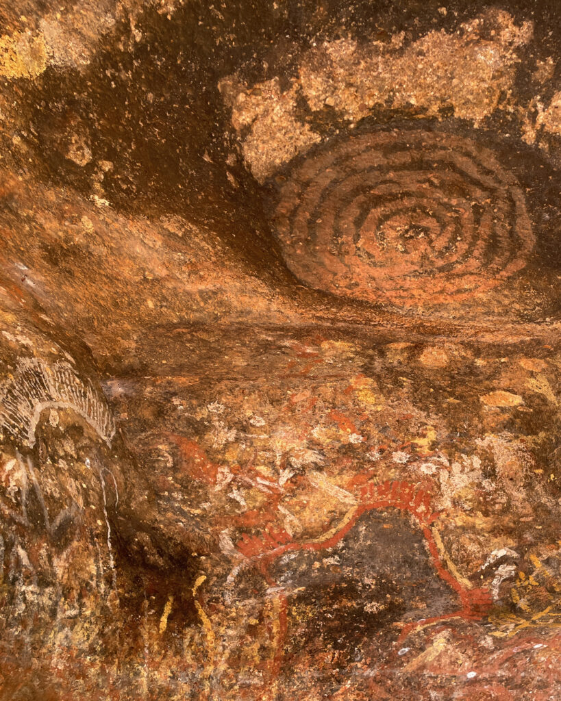

The rock walls are like a school teacher’s whiteboard. The symbols and figures painted on them represent stories and the elders use them to teach lessons about creation, laws, and good behavior. The symbols and figures have been painted in layers and some may be tens of thousands of years old. (Source)
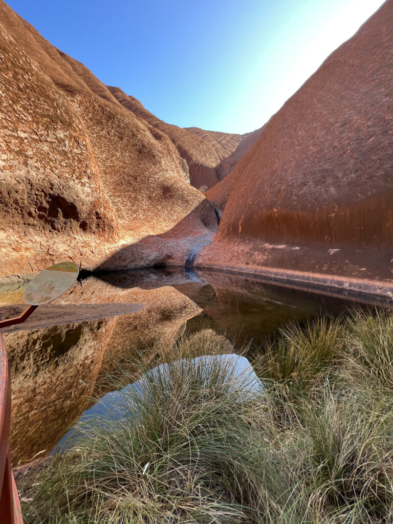

Mutitjulu Waterhole
This important waterhole is one of the few permanent sources of water at Uluru. While there, our guide told the story about a battle between creation ancestors Minyma Kuniya and Wati Liru (the woma python woman and venomous snake man). Minyma Kuniya won the battle and then she combined with her deceased nephew to became Wanampi (water snake). Wanampi lives in the waterhole and controls the source of the water.

National Park Service Information, Maps and Passes
Like most National Parks, park passes are required for entry to Uluru, and you can purchase them on the National Park’s website. The Uluru-Kata Tjuta National Park Service website also provides these great guides with maps and information:
- National Park Visitor Guide (downloadable 33 pages)
- National Park Visitor Essentials: Maps and Information (downloadable 4 pages)
Getting to Uluru-Kata Tjuta National Park from Alice Springs and Beyond
Options for getting to Uluru:
- Drive. Uluru is 450 km southwest of Alice Springs and takes about 5 hours (one-way)
- Fly or take the train to Alice Springs, then hire a car and drive, or take a tour, or fly to Ayers Rock/Connellan Airport
- Fly directly to Ayers Rock/Connellan Airport (airport code AYQ). There are flights from: Sydney, Melbourne, Brisbane, Darwin, Adelaide, and Alice Springs. To get around Uluru-Kata Tjuta National Park, either hire a car, hire a guide, get around via a resort shuttle, or use a service like Uluru hop on hop off. The airport is 30 km from Uluru

Our Flight to Uluru
We had planned to take The Ghan train through Australia’s outback a few years ago, but like so many other things, our plans were sidetracked with the pandemic. When we were finally able to book the trip, we discovered the optional day trip upgrade from Alice Springs to Uluru. We decided to take it and booked it along with our Ghan reservations.
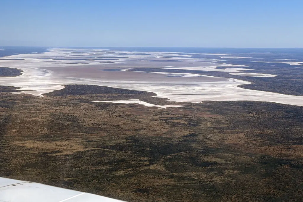
The flight took a bit over an hour. Before landing, the pilot circled Uluru in both directions so passengers on both sides of the plane could see the entire site, and then he circled Kata Tjuta too. Our time on the ground was way too short, but the closeup aerial views during the flight were priceless.
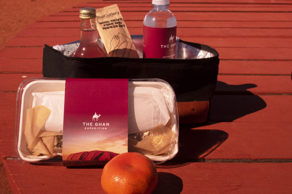
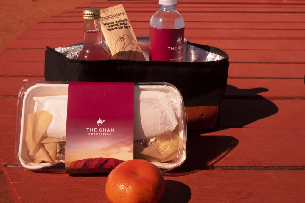
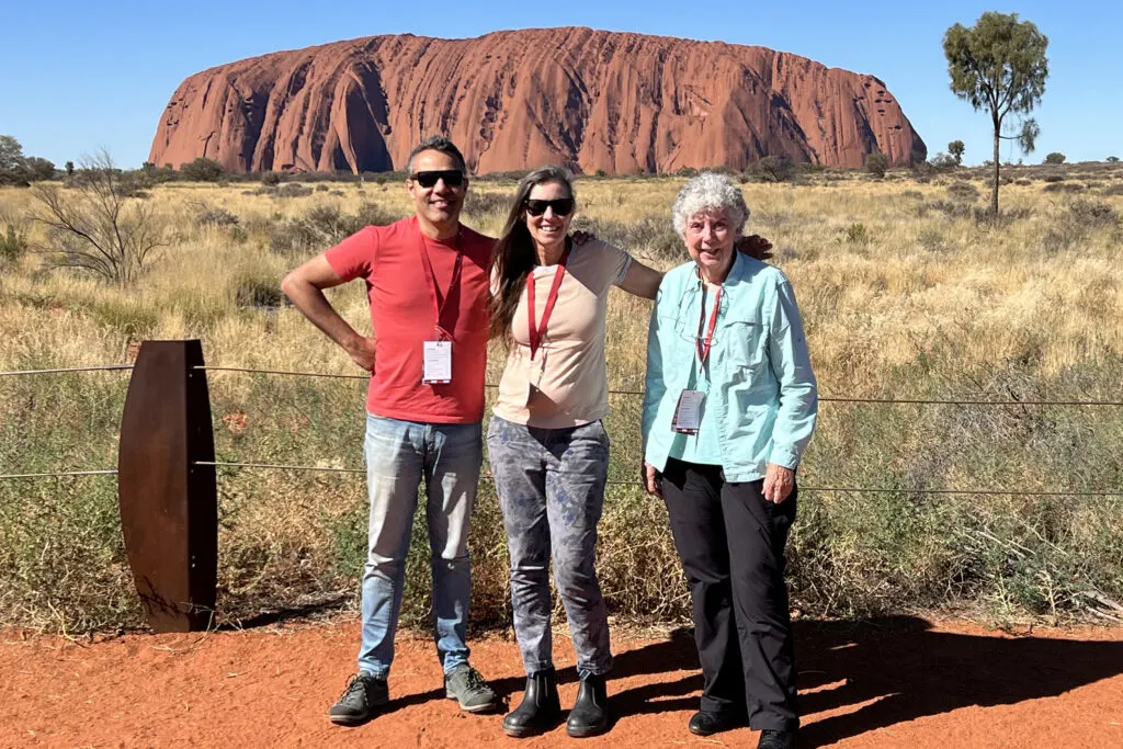
After circling Uluru and Kata Tjuta, we flew back to Ayers Rock/Connellan Airport and landed. We had lunch at an Uluru viewing site and then took the guided Kuniya Walk to Mutitjulu Cave and Waterhole.
After the Kuniya Walk we drove around part of the base of Uluru, made a quick photo op stop at the Mala car park, and then returned to the airport for our flight back to Alice Springs. Our flight was in an 8-passenger, twin engine plane operated by Northern Territory Air Services.

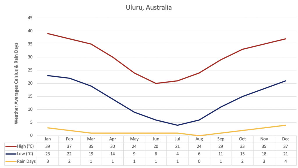
Best Time to Go: Uluru Climate and Weather
We visited Uluru in late June (early winter), and the weather was perfect. It was sunny but not humid or too hot. It would be wonderful to see Uluru in summer when it rains and water pours down the sheer walls at Mutitjulu Waterhole and Kantju Gorge. But the downside is that it’s hot and humid, and we were told the flies can be so pesky you need to wear a head net for protection.


Aboriginal Ownership and Co-management of Uluru-Kata Tjuta National Park
The land occupied by the park traditionally belonged to the Anangu (arn-ang-oo) people. In 1985, the Australia government deeded the land back to the Anangu who then leased it back to the Australian government. The Anangu people and Australian National Park System jointly manage the park. (Source)
Uluru-Kata Tjuta National Park is listed as a UNESCO World Heritage area for both natural and cultural values. The UNESCO cultural listing of the park honors the Indigenous people and their traditional beliefs as one of the oldest societies on earth. The site is sacred to them and they take great care of it. (Source)
Please Don’t Climb on Uluru
There are three very good reasons why you should stay on the trails and not climb Uluru: it’s illegal; it’s dangerous, and it’s disrespectful. It’s illegal because Australia has a “don’t climb Uluru” law. It’s dangerous because the sandstone surface is slippery and, over the years, dozens of people have died from falls. And It’s disrespectful because Uluru is a sacred place for the Anangu people.

Conclusion
We love Australia. The people are interesting, friendly, and fun. The country has spectacular and exotic landscapes, and the flora and fauna are beyond unique (have you seen an Echidna or a Duck-Billed Platypus?).
This amazing trip included visits to both Litchfield and Kakadu National Parks, riding The Ghan train through the outback, and taking a side trip to Uluru. As always, there’s never enough time to do and see all we would like and that’s especially true with our quick visit to Uluru-Kata Tjuta National Park. We need to come back.
Author bio: Ginny Vail is a travel writer, who loves sightseeing, photography, and videography. She’s been to 45 countries across six continents and traveled by air, car, bus, train, boat, and ship. Her articles can help you discover places to go, sights to see, and details about when and how to visit them.